NUOVO · PUOI PAGARE A RATE
Puoi pagare in una volta sola oppure in 5, 8 o 12 rate mensili, con carta di credito o PayPal. Il totale non cambia. Gli addebiti partono da soli ogni mese e si fermano all’ultima rata: non c’è nessun rinnovo e non devi disdire niente. Scegli la formula qui sopra.
Come funziona il pagamento a rate →
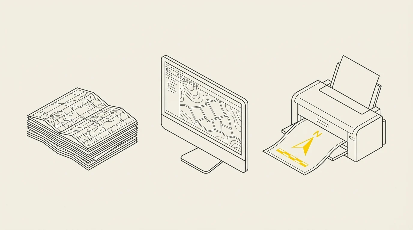
From data locked in a folder to your first printable map
Cadastre, CTR, orthophotos, shapefiles received from an external firm: the territorial data is already there. The problem is it remains unreadable, and whenever needed, you have to ask someone else.
In 4 live hours we put QGIS in your hands and guide you through the entire process: opening data, understanding it, querying it, and producing a print-ready map. QGIS is free software: no license to purchase, now or ever.
What you'll be able to do when the course ends

Open any data you receive — shapefiles, GeoPackage, orthophotos, CSV with coordinates. No more asking anyone for conversions.

Connect to official cartography without downloading it — Geoscopio by Regione Toscana and Portale Cartografico Nazionale via WMS and WFS: always up-to-date, zero space used on your PC.

Solve the problem of layers that «don’t overlap» — coordinate reference systems and reprojection, explained once and for all.

Make a map readable — styling by category, labels, display scales: from a gray blob to a clear, understandable map at a glance.

Query and measure — attribute selections, area and length calculations, basic statistics.

Draw and correct geometries — new vector layer, editing, topological checks, merging and clipping.
Georeference a paper map — from a scan to its exact position on the territory.

Produce the final map — print layout with scale, legend, and title block, exported to PDF at the correct resolution.
Program: 4 hours, eight steps
Each block concludes with an on-screen result. Minutes are approximate: if the group needs to pause on a point, we pause.
1
Installation and first launch · 20 min
Let's install QGIS together in its stable version, set up the interface, and understand where everything is: panels, toolbars, and how to save a project without ending up with an empty file.
2
Opening the data you receive · 30 min
Shapefiles, GeoPackage, orthophotos, CSV with coordinates. Attribute table, selections, and queries: finding the three parcels you need among ten thousand.
3
Coordinate reference systems, once and for all · 25 min
Why two layers 'don’t overlap', what an EPSG code is, the difference between on-the-fly reprojection and actual reprojection. This is where most people give up: we’ll clarify it here.
4
Official maps without downloading them · 25 min
Connecting to WMS and WFS services: Geoscopio by Regione Toscana and Portale Cartografico Nazionale. Always up-to-date, zero disk space used.
5
Making a map readable · 40 min
Categorized and graduated styling, labels, scale visibility. Turning a gray blob into a clear, understandable output at a glance.
6
Georeferencing a paper map · 35 min
From scanning a historical map to placing it accurately on the territory: control points, error checking, and when to trust the result.
7
The print layout · 45 min
Scale, legend, title block, north arrow, coordinate grid. Exporting to PDF at the right resolution for printing and attaching to a procedure.
8
Your map, from start to finish · 20 min
Final exercise using the course data, and time for any remaining questions.
Who it's for
Municipal technicians from technical offices, urban planning, public works, and SUAP. Surveyors, architects, and engineers who receive territorial data and need to deliver outputs. Anyone starting from scratch who has never opened a GIS.
How it works
- Duration: 4 live hours
- Where: online via Google Meet
- Materials: PDF slides and exercise datasets
- Software: QGIS, free and open-source — we guide you through installation before starting
When the course starts
New sessions launch when reaching 2 enrolled participants. Once the minimum is met, we'll contact you to jointly agree on schedule: morning, afternoon or late afternoon on weekdays - or Saturdays if the group prefers. The timetable is built around participants' availability, not imposed from above.
Duration: 4 total hours. Can be completed in a single half-day session or two 2-hour sessions on different days, as the group prefers.
We commit to starting the session within 30 days of purchase. If the minimum isn't met by then, you choose how to proceed: wait for the next available session, receive a voucher of equal value redeemable for any of our courses, or a full refund. None of these options have additional costs.
Already have a group or urgent scheduling needs? Request a new edition: with two participants, the session starts immediately.
How lessons work
The course is live, not pre-recorded: view the instructor's screen, ask questions in real time, and work together on the same data. We use Google Meet via paid Google Workspace account, making a noticeable difference versus free video calls:
- No time limits. Free group meetings cut off after 60 minutes: a 4-hour session would split three times. Paid sessions run uninterrupted.
- Sessions are recorded and available for 30 days. If you miss a step or lesson, you can review at your own pace.
- Attendance tracking. Meet generates participation reports with connection times - the document your organization may require alongside the certificate for training hour accounting.
- High-resolution screen sharing both ways. If stuck, share your screen: we troubleshoot your QGIS together instead of verbal instructions.
- Limited class size. Groups stay intentionally small: if no one can ask questions in four hours, it's not a course - it's a webinar.
What you need
- A computer Windows, macOS or Linux. Tablets are fine for viewing, not for practicing.
- A stable connection: around 3 Mbps is sufficient.
- QGIS installed. You don't need to know how to do it: in the days before the course, you'll receive a step-by-step guide, and if something doesn't work, Fabio Benvenuti will solve it with you before the course starts, not during.
- No paid accounts or software to buy: you receive a link and click.
A practical tip: if possible, use two screens, or a second device next to you. On one, you follow the instructor; on the other, you work. Those who do this follow the course much better than those who spend four hours switching between windows.
Certificate of attendance
At the end of the course, we issue a named certificate in PDF format, including the course title, duration, dates, delivery method, instructor, and a serial number—exactly the details your organization needs to account for training hours, or for your professional portfolio.
This is how it works
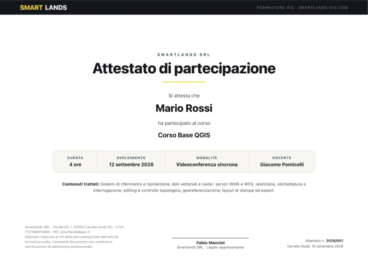
Sample certificate with demo data. The actual certificate will display your name, the actual course dates, and a unique sequential number.
Who teaches the course
Three people, three distinct roles: the instructor, the perspective of someone working in public administration, and the person who helps you if the software doesn't work.
 Instructor
Giacomo Ponticelli
Archaeologist and researcher. Conducts the lessons from start to finish: sets up exercises, demonstrates each step via shared screen, and answers questions live. Works daily with territorial data from municipalities and public bodies, so the cases presented are real-world projects, not sample datasets.
 Co-speaker
Fabio Mancini
Architect and ICT technician, CEO of SmartLands. Focuses on the connections between GIS and real office work: how data enters official processes, which regulatory and procedural constraints matter, and how to build a long-lasting archive. He’s the one who answers questions like, 'How would this work in my organization?'
 Helpdesk assistant
Fabio Benvenuti
IT technician. Supports you on technical issues throughout the course: installation, configuration, permissions, system or connection problems. If something doesn’t work on your computer, they handle it while the lesson continues —so no one falls behind due to a technical issue.
The complete path
The three courses are designed to be taken sequentially, but each also works as a standalone.
You are here
Basic QGIS Course
The foundations
Stage 2
Data and automation
Who has already chosen us
Training delivered to public administrations and professional associations
We don’t teach textbook theory: the workflows you see in class are the same ones we use daily for our clients' projects.

Municipality
San Gimignano

Municipality
Casalecchio di Reno

Professional association
Architects of Florence
For Public Administrations: valid as staff training
Starting in 2025, every public employee must complete at least 40 hours of training per year —per the Directive of the Minister for Public Administration dated 16 January 2025, which makes achieving that training quota a specific performance goal for managers. The CCNL Local Functions of November 16, 2022 (Art. 55) considers training hours as regular working hours.
The contents of this course fall under the data and documents area of Syllabus "Digital Skills for PA", the reference framework for digital staff training planning by public administrations.
We organize dedicated editions for individual entities, tailored to your territory's real data: street directories, house numbers, green areas, toponymy, signage. How it works for public entities.
Frequently asked questions
When exactly does the edition start?
Editions open once 2 enrolled participantsparticipants are reached. As soon as the group is complete, we’ll contact you to agree on days and times — morning, afternoon, or late afternoon, on weekdays or Saturdays. We commit to starting the edition within 30 days of purchase.
What if the 2 participants aren’t reached?
You choose how to proceed: wait for the next available edition or receive a voucher of equal value redeemable for any of our courses, or a full refund. None of these options have additional costs.
Is it live or a recorded video course?
Live, on Google Meet. You see the instructor’s screen, ask questions as they arise, and everyone works on the same data. The recording remains available for 30 days.
What if I miss a lesson or need to leave early?
You can review the recording, available for 30 days. If you missed an operational step, the technical assistant will get you back on track.
Who helps me if something doesn’t work during the lesson?
A dedicated technical assistant follows the entire course: resolves issues with you while the lesson continues, so you don’t hold up the class or fall behind. This is the biggest difference compared to a recorded course.
Do I need experience to start?
No. The course starts from installation and is designed for those who have never opened a GIS. If you already use QGIS and are looking for databases, analysis, and automation, the right course is
Advanced QGIS Course.
What software is needed, and how much does it cost?
QGIS, which is free and open-source: no license to purchase, now or later. Before starting, we’ll guide you through installation so you’re ready to go by the first lesson.
Is my office computer enough?
You’ll need a Windows, macOS, or Linux computer and a stable connection; the detailed requirements are above under 'What you need.' If you’re unsure about your office machine, contact us before purchasing.
Do you issue a certificate? What is its value?
Yes: a named participation certificate, with a serial number and the 4 hours completed, sent within 3 days of course completion. It’s a participation certificate and does not constitute professional certification or accreditation.
Do the hours count toward mandatory public sector training?
Starting in 2025, every public employee must complete at least 40 hours of training per year (Directive of the Minister for Public Administration dated January 16, 2025), and the CCNL Funzioni Locali of November 16, 2022, Art. 55, considers these hours as official service time. Along with the certificate, we provide the Google Meet attendance report, which is the document authorities request for reporting.
How do I pay? And the invoice?
At checkout you'll find bank transfer and PayPal (with PayPal, you can also pay by card). For bank transfers, the details and reference appear in the order confirmation and the email you receive. We always issue an invoice, and the order form will ask for the necessary details directly: client type, tax code or VAT number and, for public entities, SDI recipient code or PEC and the determination reference or CIG.
Can we purchase as a Municipality, with a determination and CIG?
Yes. When placing the order, select 'Public entity' and the form will ask for VAT number, SDI recipient code or PEC, and the determination reference or CIG: we include them in the electronic invoice. If you need a formal quote before committing to the expense,
request it here.
Can you organize an edition just for our entity?
Yes, and it’s the formula we recommend for entities: same program, but tailored to
your real data — street maps, house numbers, green areas, toponymy, signage. This way, mandatory training hours also produce tangible work.
Request the program for your entity.
There are multiple people in our office: can we enroll together?
Contact us before purchasing, indicating how many of you there are: we'll organize the group and collect names for certificates. With two or more participants, the edition starts immediately, no waiting.