NUOVO · PUOI PAGARE A RATE
Puoi pagare in una volta sola oppure in 5, 8 o 12 rate mensili, con carta di credito o PayPal. Il totale non cambia. Gli addebiti partono da soli ogni mese e si fermano all’ultima rata: non c’è nessun rinnovo e non devi disdire niente. Scegli la formula qui sopra.
Come funziona il pagamento a rate →
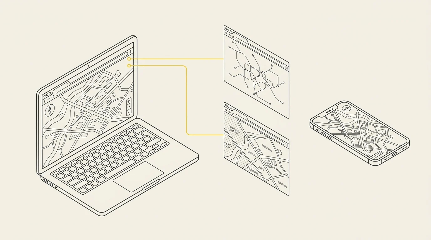
Your maps stop being files and become a website anyone can access
A PDF gets printed and becomes outdated. A web map opens in a browser, updates automatically, and can be accessed by all departments — or all citizens — without installing anything.
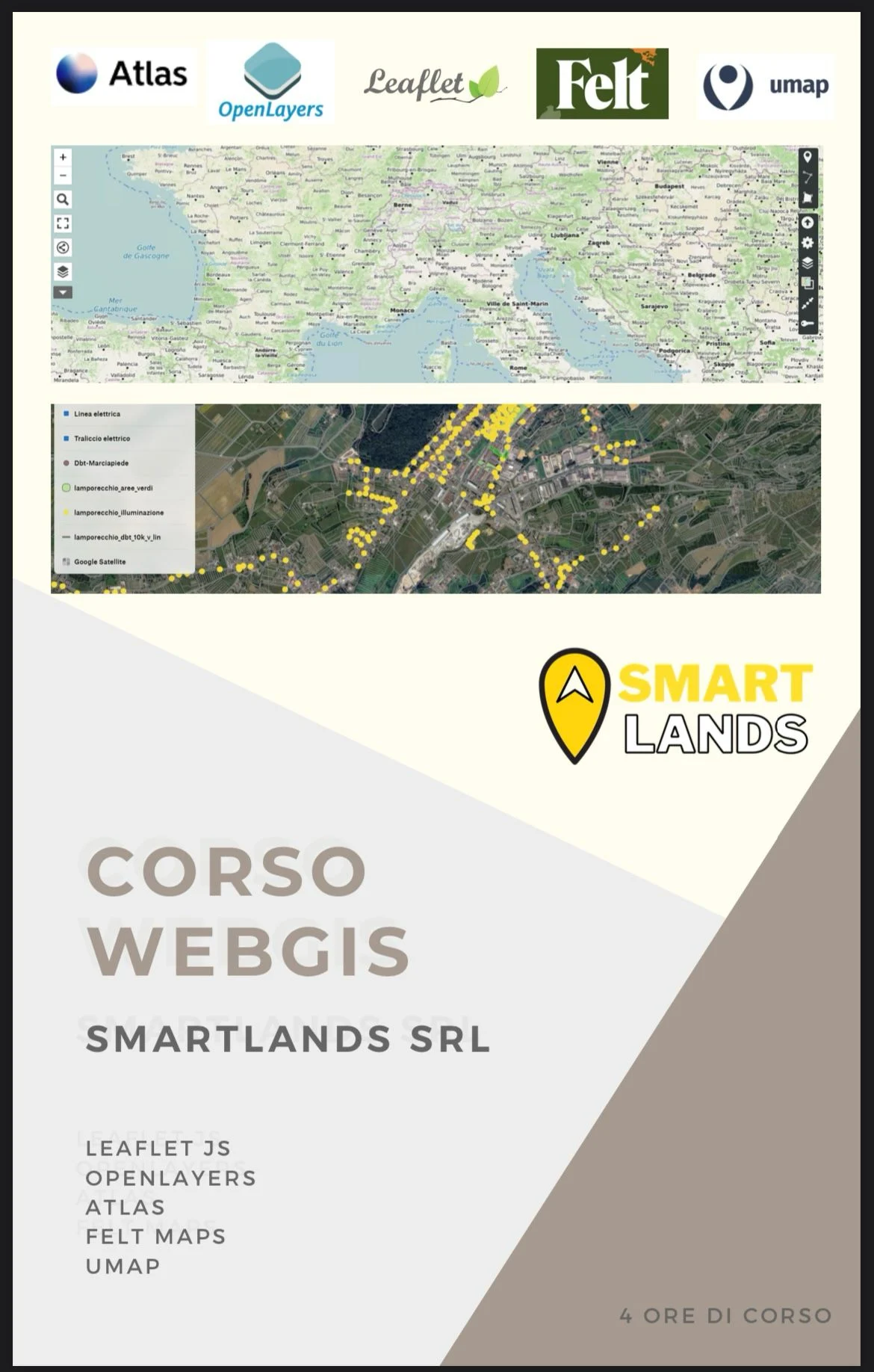
In 16 lessons spread over 8 weeks you'll build interactive web maps from scratch: first with the two JavaScript libraries that power most production WebGIS, then with tools that let you publish a map in half an hour without writing a single line of code.
What you'll be able to do when the course ends

Publish an interactive map with Leaflet — markers, popups, toggleable layers, custom styles: the world's most widely used library for web maps, lightweight and straightforward.

Manage complex projects with OpenLayers — projections, WMS and WFS services, interactions and animations: when Leaflet is no longer enough.

Publish your data online in the right format — GeoJSON, KML, remote services: what to use, when, and why a slow map is almost always due to data issues.

Publish a map online without coding — uMap for independent open-source publishing, Felt Maps for collaborative work and commenting.

Choose the right tool for the job — when uMap is enough, when Leaflet is needed, when OpenLayers is required: the decision that saves you weeks.

Deliver your own project — in the final week, you'll develop and present a complete WebGIS application that remains yours and can be shown to clients or your organization.
Program, week by week
- Introduction to WebGIS. What is a GIS, how it differs on the web, overview of course tools.
- Cartography and geodata. Principles of cartography, projections, web-friendly formats (GeoJSON, KML).
- Leaflet: basics. Installation, first project, layers, markers, event handling.
- Leaflet: customization. Styles, icons, custom popups, dynamic data.
- OpenLayers: the basics. Initial setup, layers, controls, interactions.
- OpenLayers: advanced concepts. Multiple data sources, map services, animations and advanced styling.
- Publishing without coding. uMap for open source maps, Felt Maps for collaborative work.
- Final project. Development, review and presentation of your WebGIS application.
Who it's for
Technical professionals who already produce geographical data and want to make it accessible online. Developers needing to add maps to projects. Organizations wanting to open their data to citizens.
How it works
- Duration: 16 lessons over 8 weeks, two per week
- Materials: slides, reference documentation, exercises and case studies
- Assessment: weekly exercises and final project
When the course starts
New sessions launch when reaching 2 enrolled participants. Once the minimum is met, we'll contact you to jointly agree on schedule: morning, afternoon or late afternoon on weekdays - or Saturdays if the group prefers. The timetable is built around participants' availability, not imposed from above.
Duration: 16 lessons distributed over 8 weeks, two lessons per week at a fixed time slot agreed with the group at launch.
We commit to starting the session within 30 days of purchase. If the minimum isn't met by then, you choose how to proceed: wait for the next available session, receive a voucher of equal value redeemable for any of our courses, or a full refund. None of these options have additional costs.
Already have a group or urgent scheduling needs? Request a new edition: with two participants, the session starts immediately.
How lessons work
The course is live, not pre-recorded: view the instructor's screen, ask questions in real time, and work together on the same data. We use Google Meet via paid Google Workspace account, making a noticeable difference versus free video calls:
- No time limits. Free group meetings cut off after 60 minutes: a 4-hour session would split three times. Paid sessions run uninterrupted.
- Sessions are recorded and available for 30 days. If you miss a step or lesson, you can review at your own pace.
- Attendance tracking. Meet generates participation reports with connection times - the document your organization may require alongside the certificate for training hour accounting.
- High-resolution screen sharing both ways. If stuck, share your screen: we troubleshoot your QGIS together instead of verbal instructions.
- Limited class size. Groups stay intentionally small: if no one can ask questions in four hours, it's not a course - it's a webinar.
What you need
- A computer Windows, macOS or Linux. Tablets are fine for viewing, not for practicing.
- A stable connection: around 3 Mbps is sufficient.
- QGIS installed. You don't need to know how to do it: in the days before the course, you'll receive a step-by-step guide, and if something doesn't work, Fabio Benvenuti will solve it with you before the course starts, not during.
- No paid accounts or software to buy: you receive a link and click.
A practical tip: if possible, use two screens, or a second device next to you. On one, you follow the instructor; on the other, you work. Those who do this follow the course much better than those who spend four hours switching between windows.
Certificate of attendance
At the end of the course, we issue a named certificate in PDF format, including the course title, duration, dates, delivery method, instructor, and a serial number—exactly the details your organization needs to account for training hours, or for your professional portfolio.
This is how it works
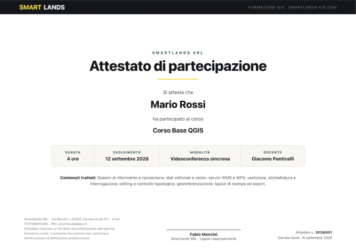
Sample certificate with demo data. The actual certificate will display your name, the actual course dates, and a unique sequential number.
Who teaches the course
Three people, three distinct roles: the instructor, the perspective of someone working in public administration, and the person who helps you if the software doesn't work.
 Instructor
Giacomo Ponticelli
Archaeologist and researcher. Conducts the lessons from start to finish: sets up exercises, demonstrates each step via shared screen, and answers questions live. Works daily with territorial data from municipalities and public bodies, so the cases presented are real-world projects, not sample datasets.
 Co-speaker
Fabio Mancini
Architect and ICT technician, CEO of SmartLands. Focuses on the connections between GIS and real office work: how data enters official processes, which regulatory and procedural constraints matter, and how to build a long-lasting archive. He’s the one who answers questions like, 'How would this work in my organization?'
 Helpdesk assistant
Fabio Benvenuti
IT technician. Supports you on technical issues throughout the course: installation, configuration, permissions, system or connection problems. If something doesn’t work on your computer, they handle it while the lesson continues —so no one falls behind due to a technical issue.
The complete path
The three courses are designed to be taken sequentially, but each also works as a standalone.
Stage 2
Data and automation
You are here
WebGIS Course
Publishing online
Who has already chosen us
Training delivered to public administrations and professional associations
We don’t teach textbook theory: the workflows you see in class are the same ones we use daily for our clients' projects.

Municipality
San Gimignano

Municipality
Casalecchio di Reno

Professional association
Architects of Florence
For Public Administrations: valid as staff training
Starting in 2025, every public employee must complete at least 40 hours of training per year —per the Directive of the Minister for Public Administration dated 16 January 2025, which makes achieving that training quota a specific performance goal for managers. The CCNL Local Functions of November 16, 2022 (Art. 55) considers training hours as regular working hours.
The contents of this course fall under the data and documents area of Syllabus "Digital Skills for PA", the reference framework for digital staff training planning by public administrations.
We organize dedicated editions for individual entities, tailored to your territory's real data: street directories, house numbers, green areas, toponymy, signage. How it works for public entities.
Frequently asked questions
When exactly does the edition start?
Editions open once 2 enrolled participants. Once the group is complete, we’ll agree on a fixed time slot for the two weekly lessons. We commit to starting the edition within 30 days of purchase.
What if the 2 participants aren’t reached?
You choose how to proceed: wait for the next available edition or receive a voucher of equal value redeemable for any of our courses, or a full refund. None of these options have additional costs.
Is it live or a recorded video course?
Live, on Google Meet. You see the instructor’s screen, ask questions as they arise, and everyone works on the same data. The recording remains available for 30 days.
What if I miss a lesson or need to leave early?
You can review the recording, available for 30 days. If you missed an operational step, the technical assistant will get you back on track.
Who helps me if something doesn’t work during the lesson?
A dedicated technical assistant follows the entire course: resolves issues with you while the lesson continues, so you don’t hold up the class or fall behind. This is the biggest difference compared to a recorded course.
Do I need to know how to program?
You don’t need to be a developer: we start from the basics and work with ready-to-adapt examples. Some minimal familiarity with HTML and JavaScript makes the process much smoother. If you’ve never seen a line of code, the week dedicated to uMap and Felt will still give you a publishable result.
Eight weeks is a lot: what if work gets in the way?
Lessons are live but remain recorded for 30 days, and weekly exercises don’t have a strict deadline. The final project is the only appointment you shouldn’t reschedule.
Do I keep the final project?
Yes. In the last week, you develop and present a complete WebGIS application that remains yours: you can show it to a client or publish it for your organization.
Do you issue a certificate? What is its value?
Yes: a personalized participation certificate, with a serial number and hours completed, sent within 3 days of the course ending. It’s a participation certificate: it does not constitute professional certification or accreditation.
Do the hours count toward mandatory public sector training?
Starting in 2025, every public employee must complete at least 40 hours of training per year (Directive of the Minister for Public Administration dated January 16, 2025), and the CCNL Funzioni Locali of November 16, 2022, Art. 55, considers these hours as official service time. Along with the certificate, we provide the Google Meet attendance report, which is the document authorities request for reporting.
How do I pay? And the invoice?
At checkout you'll find bank transfer and PayPal (with PayPal, you can also pay by card). For bank transfers, the details and reference appear in the order confirmation and the email you receive. We always issue an invoice, and the order form will ask for the necessary details directly: client type, tax code or VAT number and, for public entities, SDI recipient code or PEC and the determination reference or CIG.
Can we purchase as a Municipality, with a determination and CIG?
Yes. When placing the order, select 'Public entity' and the form will ask for VAT number, SDI recipient code or PEC, and the determination reference or CIG: we include them in the electronic invoice. If you need a formal quote before committing to the expense,
request it here.
Can you organize an edition just for our entity?
Yes, and it’s the formula we recommend for entities: same program, but tailored to
your real data — street maps, house numbers, green areas, toponymy, signage. This way, mandatory training hours also produce tangible work.
Request the program for your entity.
There are multiple people in our office: can we enroll together?
Contact us before purchasing, indicating how many of you there are: we'll organize the group and collect names for certificates. With two or more participants, the edition starts immediately, no waiting.